Telematics and Driver Safety | Save Time, Save Money, Drive Safe
Vehicle Tracking, Video Telematics and Driver Safety Solutions
Vehicle Tracking, Video Telematics and Driver Safety Solutions
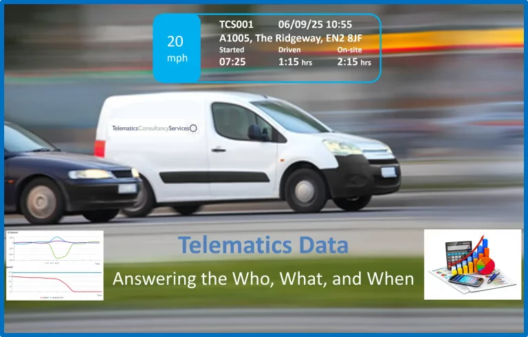
Telematics Data Evidence. Answering the Who, What, and When.
In today’s location-dependent world, telematics, location-dependent information and vehicle status are with us at all times.
Smartphones with built-in GPS, health and activity-tracking apps, satellite navigation in our cars, dashcams, and vehicle-tracking systems for safety and insurance requirements; modern vehicles also include Automotive Telematics. One aspect of this is that cars have several ECUs (Electronic Control Units) that record GPS latitude and longitude, time, and vehicle status, such as ignition on/off, speed, acceleration and braking, door opening and closing, and even call lists and calls made.
Almost all companies with commercial vehicles utilise GPS vehicle tracking for operational management, and it is particularly prevalent in rental and leased vehicles for asset management. Add to this the use of vehicle tracking for insurance and customer self-installations for theft protection, as well as the number of smartphones in use and the availability of Telematics data, which is, to some degree, ubiquitous.
The list keeps on expanding.
The “raw” data available on the device varies in level of detail and ease of extraction, whether it is from a vehicle tracking system, a smartphone, or data recorded in a vehicle’s ECUs. Access to specific devices, such as vehicle ECU data, may require physically removing hardware from the car and retrieving the data in a workshop/laboratory setting. Some smartphone data can be easily exported to Excel, but forensic software may be required to extract and convert it into usable formats. Telematics data from aftermarket-fitment vehicle tracking units used for stolen-vehicle tracking or insurance purposes can be exported from the customer application; however, it may be limited in detail or require additional requests to the Telematics Service Provider. Most will hold detailed historical data for over a year.
Not all devices and Telematics Service Providers use a standard file format for data; however, all will include basic Latitude and longitude values and timestamps as a starting point. The accuracy of the location data and speed values needs to be explained, along with potential errors due to signal loss or adverse environmental conditions. GPS timestamps are highly accurate, but they must be correctly offset to GMT, and the GPS location and speed accuracy tolerances must be accounted for.
Access to data as early as possible, to ensure no data has been deleted due to storage constraints or similar, is vital, and the role of the Telematics Data Analyst is to initially validate the data, ensure its completeness and format the data so it is suitable for analysis and display on a mapping platform.
With access to this location-dependent data, analysis can be performed to answer specific questions, compare with witness statements, determine where an event occurred using GPS latitude and longitude values, and when, based on accurate GPS timestamps.
The objectives in the analysis are many.
In a Death by Dangerous Driving case, the data can show the vehicle’s speed up to the accident locus, deceleration, and, within GPS tolerance, the position on the road. This data can be plotted in graphs and on satellite maps, allowing visual interpretation of the events. This can assist in answering questions such as when the vehicle began braking, its speed, how far from the accident locus the car was before initiating an avoidance action (if any), and in supporting or contradicting witness statements.
In criminal cases involving vehicles, whether used in shootings, drug offences, or robberies, telematics data has been used as evidence in many such cases. The data can be used to create a timeline of events, place a vehicle at specific locations and for a certain period, determine whether multiple vehicles were in similar locations at the same time, and again visualise events on satellite maps, supporting or contradicting witness statements.
Even if no vehicles are involved, smartphone location and activity data, along with GPS records, can be used to determine a sequence of events. Activity and health monitoring Apps record steps taken and when, as well as stairs climbed, with accurate timestamps. All of this is very useful in validating a person’s movements.
It must be noted that the location and event data indicate only the device’s activity from which the data were extracted, not who was in a vehicle at a specific time or who was holding a smartphone. The data needs to be compared with other evidence, such as witness statements or CCTV footage, to confirm who was in a vehicle or using a phone.
One such area for comparison is against Cell Site records. For example, the location of a vehicle, as recorded by Telematics GPS, may not match the Cell Site records of a phone associated with individuals in the vehicle.
The visual representation of events on maps and charts provides context to the data, enabling legal teams and juries to gain a deeper understanding of written statements and evidence presented.
An experienced Telematics Data Analyst can ensure that the “raw” data is presented in a format that answers legal teams’ questions, provides context, supports or contradicts witness statements, supports event timelines, and allows juries to gain a greater understanding through visual representation of the data.
Published in The London Advocate Autumn 2025 Newsletter